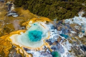
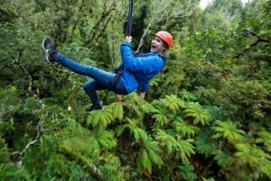
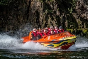
レインボーマウンテン景観保護区

ロトルア

地熱 観光名所

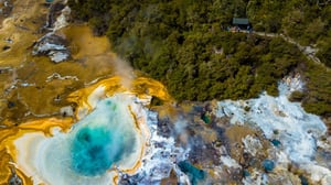
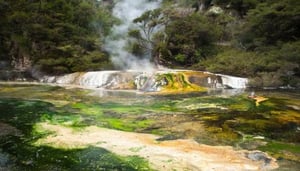
レインボーマウンテン景観保護区は、珍しい植物種や印象的な色彩の地形を含む地熱風景です。タウポからまたはロトルアの南東26キロに位置し、国道5号線からすぐの場所にあります。

その火山の起源から、レインボーマウンテン(Maungakakaramea)は、褐色、オレンジ色、赤土壌、再生中の原生植生を持つ燻煙する風景を見せています。

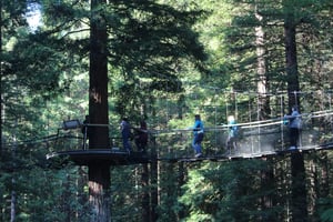
保護区には地形を探索するための数本のハイキングコースがあります。レインボーマウンテンクレーターレイクトレイルは1キロで、片道30分程度かかります。より長いレインボーマウンテンサミットトラックは2.5キロあり、片道1時間15分かかります。山頂での景色は360度を見渡し、南にはトンガリロ国立公園の火山峰とタウポ湖、北にはタラウェラ山とタラウェラ、レレファカイトゥとロトマハナの湖が広がります。西にはパエロア山脈が見え、東にはカイマノワ森林とウレウエラ山脈が見えます。

レインボーマウンテンサミットトラックは印象的なマウンテンバイクループの一部を形成しています。サイクリストは、ケロシンクリークまたは国道5号線の駐車場から始まる等級2の「テ・アラ・アヒ」トレイルで開始することができます。その後、山頂トラックを登り、等級4のマウンテンバイク専用トラックであるテ・ランガで下ることができます。

行き方:

ロトルアから近づくと、保護区には、SH 38(ムルパラ・ワイカレモアナ・ハイウェイ)の分岐のすぐ後ろに見つかる、道路左側にある駐車場からアクセスできます。

地熱風景が壊れやすく、危険があるため、犬、馬、自転車は指定されたトラックに従う必要があることにご注意ください。

Contact

Directions

Book Nearby Accommodation

Get Directions

Are you a business owner in Rotorua?

My Guide Rotorua, an informative and user-friendly online guide, was created for all those interested in the Rotorua region.

Used daily by travellers, tourists, residents and locals, powered by Local Experts, our site reaches the people who are your potential customers.

  • WhatsApp Enquiries
  • Integrate your chosen Booking platform
  • Gallery with Videos & Virtual Tours
  • Downloadable PDFs (Menus , Pricing lists..)
  • Event Promotion Included
  • Website Link
  • Social Media links
Find Out More

My Lists

Create New Guide

OR

Mini Guides
Arrow

Login to create your guides for Rotorua.

Add to My Guide

Create New Guide

Cancel

Cancel

Book 経験 in Rotorua

We Are Part of the My Guide Network!

My Guide Rotorua is part of the global My Guide Network of Online & Mobile travel guides.

We are now in 180+ Destinations and Growing. If you are interested in becoming a local travel partner and would like to find out more then click for more info about our Website Business Opportunity.

Nearby Destinations

Events in Rotorua

Please select a Date first.

Search for a company in Rotorua